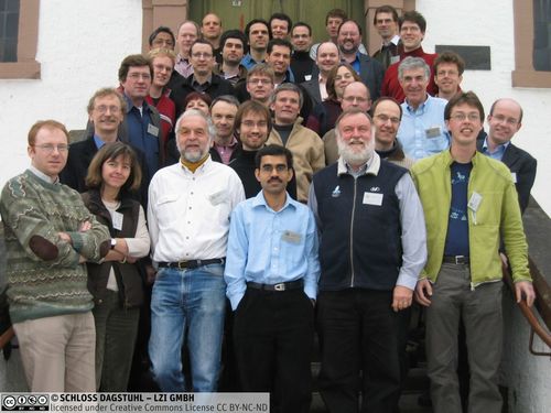
Dagstuhl Seminar 06101
Spatial Data: Mining, Processing and Communicating
( Mar 05 – Mar 10, 2006 )
Permalink
Organizers
- Jörg-Rüdiger Sack (Carleton University - Ottawa, CA)
- Monika Sester (Leibniz Universität Hannover, DE)
- Peter van Oosterom (TU Delft, NL)
- Michael Worboys (University of Maine, US)
Contact
Press/News
Impacts
- Area aggregation in map generalisation by mixed-integer programming : article pp. 1871-1897 - Haunert, Jan-Henrik; Wolff, Alexander - London : Taylor & Francis, 2010 - (International Journal of Geographical Information Systems ; 24. 2010, 12 : pp. 1871 - 1897). DOI: 10.1080/13658810903401008.
- Generalization of land cover maps by mixed integer programming : article in ACM GIS 2006 : S. 75-82 - Jan-Henrik Haunert ; Alexander Wolff - New York : ACM, 2006. - S. 75-82 - (Proceedings of the 14th annual ACM international symposium on advances in geographic information systems <2006, Arlington>). ISBN: 1-59593-529-0. DOI: 10.1145/1183471.1183485.
This workshop has been organized as a successor to four preceding ones. The major goal has been to bring together experts from digital cartography, spatial modelling, computational geometry and cognitive science to meet with professionals from data mining and data interpretation. This has lead to a fruitful exchange of different - but very close - disciplines and hopefully to the creation of new collaborations. The Dagstuhl seminar has not only posed R&D problems, but provided crucial incentives and directions shaping the entire field. The group of participants was diverse both w.r.t. to their academic discipline and their professional background. Researchers and developers from within industry, government, and universities (senior and young) sha-red their latest topics, problems, doubts, and investigations.
Challenges
The importance of spatial data in our daily lives is rapidly increasing and so are the challenges and demands on the research and commercial communities to address the different facets of spatial data. In these communities, spatial data have generated tremendous interest over the last decade.
Interpretation of spatial constellations or situations is a process, that is closely linked to human capabilities and can be formalized using formal semantics (OWL, ODM, etc.). Making implicit information explicit is needed not only for many spatial analysis problems, but also for aspects of information communication: in digital cartography a "hot topic" today is adaptive visualization. A user is presented exactly the information that is needed for a specific purpose in a dedicated specific situation. This presumes that first of all such a situation is identified, and secondly an adaptive presentation is generated from it. A typical adaptation is made according to the scale or resolution of the data - the traditional generalization problem. However, adaptation can be interpreted in a much wider way by also adapting according to the personal profile, behaviour and wishes of the user. Such adaptive representations are especially important in the context of mobile or wireless GIS, where the spatial information has to be transmitted via possibly limited bandwidth channels.
Spatial data also pose exciting questions for the algorithms and data structuring com-munities. It is vital that computational geometrists meet with the spatial data communi-ty to exchange ideas, pose problems and offer solutions. Most algorithmic problems arising in that field are indeed geometric.
Many different application areas arise from the general availability of spatial data, e.g. using data in mobile applications, integrating data for complex tasks (e.g. traffic moni-toring, risk management), inferring behaviour patterns from data sets. The problems relating to data interpretation and data mining with respect to these applications have been discussed in the seminar. Other integrated topics are ubiquitous spatial proces-sing and formal spatial semantics.
Outcomes
Outcomes of the seminar include a collection of abstracts, presentations (slides) and some papers surveying the current state of the art in this field and latest research initi-atives (available on the website http://www.dagstuhl.de/06101/Materials/). Similar to the previous seminar on ‘computational cartography and spatial modeling’, it is expec-ted that new partnerships and collaborations between multi-disciplinary groups (rein-forced and established during the current seminar) will further advance this field with the inclusion of emerging topics.
Another important result of the seminar is the ‘Challenges of GIScience - green + red topic list’, which can be found on the seminar’s website. The idea was to identify topics for the next 5 years that are worth and challenging to work on - and at the same time also state, which topics should not be treated.
- Claus Brenner (Leibniz Universität Hannover, DE) [dblp]
- Dirk Burghardt (TU Dresden, DE) [dblp]
- Leila De Floriani (University of Genova, IT) [dblp]
- Satyan Devadoss (Williams College - Williamstown, US)
- Jürgen Döllner (Hasso-Plattner-Institut - Potsdam, DE)
- Max J. Egenhofer (University of Maine, US) [dblp]
- Sagi Filin (Technion - Haifa, IL)
- Andrew U. Frank (TU Wien, AT) [dblp]
- Christian Freksa (Universität Bremen, DE) [dblp]
- Joachim Gudmundsson (NICTA - Sydney, AU) [dblp]
- Jan-Henrik Haunert (Universität Würzburg, DE) [dblp]
- Christopher B. Jones (Cardiff University, GB)
- Thomas H. Kolbe (Universität Bonn, DE)
- Ravi Kothuri (Oracle Corp. - Nashua, US)
- Werner Kuhn (Universität Münster, DE) [dblp]
- Hugo Ledoux (University of Glamorgan, GB)
- Stephan Nebiker (Fachhochschule Nordwestschweiz, CH)
- Silvia Nittel (University of Maine, US)
- Martin Nöllenburg (KIT - Karlsruher Institut für Technologie, DE) [dblp]
- Volker Paelke (IG - Castelldefels (Barcelona), ES)
- Wilko Quak (TU Delft, NL)
- Nicolas Regnauld (Ordnance Survey - Southampton, GB)
- Jörg-Rüdiger Sack (Carleton University - Ottawa, CA) [dblp]
- Hanan Samet (University of Maryland - College Park, US)
- Thomas Seidl (RWTH Aachen, DE) [dblp]
- Monika Sester (Leibniz Universität Hannover, DE) [dblp]
- Bettina Speckmann (TU Eindhoven, NL) [dblp]
- John Stell (University of Leeds, GB)
- Rodney James Thompson (TU Delft, NL)
- Marc van Kreveld (Utrecht University, NL) [dblp]
- Peter van Oosterom (TU Delft, NL)
- Steffen Volz (Universität Stuttgart, DE)
- Robert Weibel (Universität Zürich, CH) [dblp]
- Peter Widmayer (ETH Zürich, CH) [dblp]
- Stephan Winter (The University of Melbourne, AU) [dblp]
- Alexander Wolff (Universität Würzburg, DE) [dblp]
Related Seminars
- Dagstuhl Seminar 9645: Computational Cartography (1996-11-04 - 1996-11-08) (Details)
- Dagstuhl Seminar 99381: Computational Cartography (1999-09-19 - 1999-09-24) (Details)
- Dagstuhl Seminar 01191: Computational Cartography and Spatial Modelling (2001-05-06 - 2001-05-11) (Details)
- Dagstuhl Seminar 03401: Computational Cartography and Spatial Modelling (2003-09-28 - 2003-10-03) (Details)
- Dagstuhl Seminar 09161: Generalization of spatial information (2009-04-13 - 2009-04-17) (Details)


