Dagstuhl-Seminar 13492
Geosensor Networks: Bridging Algorithms and Applications
( 01. Dec – 06. Dec, 2013 )
(zum Vergrößern in der Bildmitte klicken)
Permalink
Bitte benutzen Sie folgende Kurz-Url zum Verlinken dieser Seite:
https://www.dagstuhl.de/13492
Organisatoren
- Matt Duckham (The University of Melbourne, AU)
- Stefan Dulman (TU Delft, NL)
- Jörg-Rüdiger Sack (Carleton University - Ottawa, CA)
- Monika Sester (Leibniz Universität Hannover, DE)
Kontakt
- Annette Beyer (für administrative Fragen)
Programm
This seminar aims to advance research into, and application of geosensor networks by enhancing interdisciplinary and cross-domain collaboration. Geosensor networks (wireless sensor networks tasked with monitoring changes in geographic space) hold the potential to revolutionize the capture and management of information critical to a wide variety of important applications, including emergency preparedness and response, intelligent transportation, and environmental monitoring. Yet this potential is today not being realized. The enormous diversity of applications and expertise connected with different facets of geosensor networks present substantial barriers to integrated, cross-disciplinary research. The result today is many niche solutions to specific problems, where what is needed are a few general solutions to broader problems.
For example, environmental monitoring applications are frequently data-centric, where the identity of the sensor is unimportant compared to what it can sense; by contrast intelligent transportation applications are frequently address-centric, where the identity of sensors and the platforms to which they are attached (like people and vehicles) may be as important as what those devices can sense. Despite these differences, both environmental monitoring and intelligent transportation also face similar problems, such as in identifying vague and ill-defined spatiotemporal objects, like “hot-spots” in the case of environmental monitoring and “traffic jams” in the case of intelligent transportation. This seminar will bring together researchers and practitioners with diverse expertise, from the foundations of distributed and spatial computing, through spatial information science and computational geometry, to key applications of geosensor network technology. In doing so, the aim is to identify synergies and opportunities that help to increase the impact of research into practical applications of geosensor networks.
The seminar will be structured around three complementary perspectives: models and algorithms; benchmarking and applications; and teaching and curricula. The objective of the models and algorithms perspective is to survey, catalog, and compare the ontologies, representations, algorithms, and data structures that are fundamental to computing in geosensor networks. Through the benchmarks and application perspective, the seminar aims to improve comparability and compatibility in models and algorithms, as well as connect existing models and algorithms more directly to practical uses. Input from experts in a range of applications is anticipated, but with a particular focus on the key application areas of emergency response, intelligent transportation, and environmental monitoring. As a capstone, the teaching and curricula perspective aims to distil and collate the collected expertise in models, algorithms, benchmarks, and applications into a coherent body of knowledge. The objective is to construct a “library” of core concepts and techniques for computation with and application of geosensor networks.
The seminar will focus less on presenting individual lectures than on achieving the objectives above through collaborative discussions and activities. Using a workshop-style format, the seminar aims to elicit answers to the question of what are the essential elements of our library, how it could be designed, and what potential obstacles could arise. The aim will be to advance the field through consensus on priorities and providing opportunities for new innovations to emerge from new collaborations.
The aims of Dagstuhl Seminar 13492, "Geosensor Networks: Bridging Algorithms and Applications," were to advance research into, and application of geosensor networks by enhancing interdisciplinary and cross-domain collaboration. The premise of the Seminar was that the potential for useful, practical applications of geosensor networks (wireless sensor networks tasked with monitoring changes in geographic space) are being held back by the enormous diversity of applications and expertise connected with different facets of geosensor networks. The result today is many niche solutions to specific problems, where what is needed are a few general solutions to broader problems.
More specifically, the diversity of concepts, approaches, and tools used in connection with geosensor networks is inhibiting more rapid and fruitful research and development. Examples of this diversity include:
- Ontologies, representations, and models: The diversity of uses of geographic information leads inexorably to diversity in the different ontologies, representations, and models commonly used to conceptualize that information.
- Algorithms and data structures: The plethora of models, algorithms, data structures, and architectures that exist in the literature are frequently incompatible, founded on divergent assumptions and inconsistent approaches.
- Applications: While the potential applications of geosensor networks are legion, today we lack agreement on a set of applications that together encompass and illustrate the bulk of issues faced by all applications.
- Benchmarks, tools, and technologies: Perhaps more than any other single issue, a lack of consensus on core benchmark data sets, problems, simulation systems, and software tools inhibits convergence in research and application.
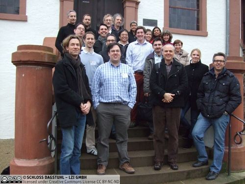
Participants
To begin to address this diversity, and bridge the gap between theory and application, the Seminar participants represented a broad spectrum of disciplines, including computer science, geographic information science, computational geometry, statistics, artificial intelligence, pervasive computing. The seminar had strong groundings in previous Dagstuhl Seminars, including Seminars 10491 and 12512 on Representation, Analysis and Visualization of Moving Objects, and Seminar 06361 on Computing Media and Languages for Space-Oriented Computation. However, we were very pleased that the Seminar also attracted a significant proportion of newer Dagstuhl attendees: more than half the attendees had attended at most one Dagstuhl seminar before, with around one quarter of Seminar participants attending their first ever Dagstuhl.
Bringing together this diversity of backgrounds, expertise, and experiences was central to the core aim of building bridges between related fields, and was central to the success of the Seminar.
Format
The seminar was structured around three complementary perspectives: models and algorithms; benchmarking and applications; and teaching and curricula. The objective of the models and algorithms perspective was to survey, catalog, and compare the ontologies, representations, algorithms, and data structures that are fundamental to computing in geosensor networks. Through the benchmarks and application perspective, the seminar aimed to improve comparability and compatibility in models and algorithms, as well as connect existing models and algorithms more directly to practical uses. Focal applications included emergency response, intelligent transportation, smart materials, and environmental monitoring. As a capstone, the teaching and curricula perspective aims to distill and collate the collected expertise in models, algorithms, benchmarks, and applications into a coherent body of knowledge: a "library" of core concepts and techniques for computation with and application of geosensor networks.
The seminar focused less on presenting individual lectures than on achieving its objectives above through collaborative discussions and activities. The organizers invited three speakers with diverse backgrounds to give longer talks (40 minutes) and lead the subsequent discussions. The three speakers were René Doursat (CNRS, Paris, discussing organic computing), Thomas Kirste (Universität Rostock, discussing situational awareness and intention recognition using sensed data), and Edzer Pebesma (Universität Müunster, on spatial data analysis with sensor data). As well as providing an introduction to the breadth and depth of ideas related to the field, the speakers were able inspire the participants and spark many subsequent discussions.
The majority of the seminar then focused on workshop-style discussion and break-out groups. In this way the seminar aimed to elicit answers to the question of what are the essential elements of computing with geosensor network. The aim was be to advance the field through consensus on priorities as well as providing opportunities for new innovations to emerge from new collaborations. The working groups' discussions and conclusions are summarized in this report (Section 5). Broadly, the working groups' focuses included spatial computing (e.g., self-organization and smart materials); applications of sensor networks (e.g., developing countries and big data); social issues (e.g., privacy); education (e.g., teaching resources and curriculum); and data and benchmarking.
However, even though the primary focus was on discussion and collaboration, the program still allowed time for short focus talks from participants (up to 10 minutes for senior researchers, or up to 15 minutes for junior researchers---researchers were able to self-select as to whether they regarded themselves as junior or senior). A summary of the focus talks given by participants is also contained in this report. All the speakers were asked to address one of the three Seminar perspectives (models and algorithms; benchmarking and applications; and teaching and curricula), as can be seen from section 4.
Outcomes
The participants were highly satisfied with the quality of the seminar. Many and diverse research results were presented during the Seminar, surveyed in the following sections. As with many Dagstuhl Seminars, the new collaborations and results of those collaborations are ongoing. However, amongst the key findings and ongoing collaborations, we highlight:
- Considerable progress has been made in recent years in the areas of (decentralized) spatial computing. This includes advances in the bottom-up design of distributed and decentralized algorithms. However, in contrast top-down aggregate programming techniques offer an important advantage over more conventional decentralized programming, in that they are substantially less complex for developers to use. Whatever future advances in this area may hold, the Seminar participants were agreed in that decentralization is a means, but never an ends. A focus on the behavior of a distributed geosensor network as a whole, rather than the rules required to generate that behavior, should always be the focus. In this respect, the focus on emergent behaviors found in spatial computing would seem ideally suited.
- One particular area of progress at the seminar was in teaching and curriculum. Despite the wide range of expertise and academic backgrounds of the participants, the Seminar exposed the considerable commonality and agreement around the fundamental concepts behind geosensor networks. This convergence was evident in the recent development of tools (such as the Proto aggregate programming language) and the publication of text books on the subject of geosensor networks.
- n contrast, one area of particular difficulty was in benchmarking and data sets. The availability of data sets is unquestionably increasing, as evidenced by several different data sets that were made available at, and through the preparatory work by participants in advance of the Seminar. However, the wide diversity of requirements for data sets across different applications continues to defy standardization or convergence on a small set of benchmarks. Issues such as validation and ground truthing; requirements for massive data sets with thousands or millions of sensors; metadata and provenance; and privacy issues were all various inhibitors to the development of a small set of benchmark data sets.
- inally, the Seminar highlighted the numerous practical, social, and environmental challenges that still remain to truly bridging the gap between theoretical algorithms and practical applications, such as cost and deployment strategies, privacy, and environmental pollution. Although these issues remain largely unsolved longer-term research problems, they are already the explicit focus of several new collaborations that have directly resulted from this Seminar.
 Creative Commons BY 3.0 Unported license
 Matt Duckham, Stefan Dulman, Jörg-Rüdiger Sack, and Monika Sester
- Annalisa Appice (University of Bari, IT) [dblp]
- Jacob Beal (BBN Technologies - Cambridge, US) [dblp]
- Susanne Bleisch (The University of Melbourne, AU) [dblp]
- Nikolaus Correll (University of Colorado - Boulder, US) [dblp]
- René Doursat (CNRS - Paris, FR) [dblp]
- Matt Duckham (The University of Melbourne, AU) [dblp]
- Stefan Dulman (TU Delft, NL) [dblp]
- Daniel Fitzner (Leibniz Universität Hannover, DE) [dblp]
- Allison Kealy (The University of Melbourne, AU) [dblp]
- Thomas Kirste (Universität Rostock, DE) [dblp]
- Steve Liang (University of Calgary, CA) [dblp]
- Marco Mamei (University of Modena, IT) [dblp]
- Sabrina Merkel (KIT - Karlsruher Institut für Technologie, DE) [dblp]
- Zoltan Papp (TNO - The Hague, NL) [dblp]
- Edzer Pebesma (Universität Münster, DE) [dblp]
- Bernd Resch (Universität Heidelberg, DE) [dblp]
- Kay Römer (TU Graz, AT) [dblp]
- Jörg-Rüdiger Sack (Carleton University - Ottawa, CA) [dblp]
- Hedda R. Schmidtke (Carnegie Mellon University - Moffet Field, US) [dblp]
- Monika Sester (Leibniz Universität Hannover, DE) [dblp]
- Martijn Warnier (TU Delft, NL) [dblp]
Klassifikation
- data structures / algorithms / complexity
- modelling / simulation
- society / human-computer interaction
Schlagworte
- geosensor networks
- spatial information science
- spatial computing
- geoinformatics
- intelligent transportation systems
- environmental monitoring
- emergency management and response